


Thirty Years After the Great Flood, the Mountain Remembers
- Marie Kennedy
- Feb 6
- 2 min read

This month marks the 30th anniversary of the Great Flood of 1996, a natural disaster that reshaped the Mount Hood corridor and tested the resolve of communities of the Mount Hood corridor.
The winter of 1995–96 had been unsettled from the start. Snowpack was thin through much of December and early January. Then a late-month Arctic blast buried the Cascades under several feet of snow, which turned to ice, setting the stage for what followed.
On February 6, a warm Pineapple Express pushed ashore. Temperatures climbed into the 50s and rain fell hard. At Government Camp, more than 11 inches of rain came down in four days. The warm rain tore into the fresh snowpack, sending runoff and melting ice down steep canyons throughout the Mount Hood National Forest.
For many area residents, the crisis arrived in the dark early hours. Writing in the March 1996 issue of The Mountain Times, my husband Tom Teven – then co-publisher of the paper – described how “placid streams and rivers turned into torrents of devastation.”
Many residents were awakened by the sound of rushing water, trees snapping and crashing, or neighbors knocking on doors. Phone lines went down, roads disappeared overnight, and in some areas, people were suddenly cut off from help. Before the era of cell phones and text messages, the Hoodland Fire Department and volunteers drove where they could, announcing that evacuations were underway. That’s how Tom and I learned that we needed to leave – immediately. For many of us, those first hours were a mix of fear and disbelief.
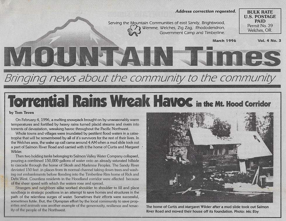
At 4 a.m., a massive mudslide tore through Salmon River Road, destroying a home. Two holding tanks owned by the Salmon Valley Water Company collapsed, releasing roughly 150,000 gallons of water onto a hillside and shifting another house off its foundation. The Sandy River jumped its banks, carving a new channel nearly 150 feet from its original course and taking century-old trees with it.
In Clackamas County, public damage estimates ran into the tens of millions of dollars, with additional losses reported to roads and Forest Service facilities. Countywide, more than 140 landslides were recorded and dozens of highway locations were closed. Across Oregon, eight people lost their lives.
In an area long familiar with flooding, the mountain has continued to remind residents of the power of storms.
In 2006, a major debris flow removed a section of Highway 35 at White River, while parts of Lolo Pass Road were completely washed out. In 2011, heavy flooding along the Sandy and Salmon Rivers forced the evacuation of more than 200 people on Lolo Pass Road, and two homes were swept away.


Comments